2017 USGS 3DEP Lidar: Fairbanks, AK (QL1 & QL2)
Data Set (DS) | OCM Partners (OCMP)GUID: gov.noaa.nmfs.inport:55358 | Updated: October 17, 2023 | Published / External
Summary
Short Citation
OCM Partners, 2025: 2017 USGS 3DEP Lidar: Fairbanks, AK (QL1 & QL2), https://www.fisheries.noaa.gov/inport/item/55358.
Full Citation Examples
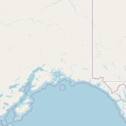
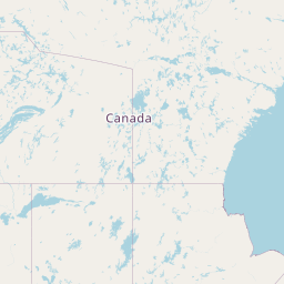
In May 2017, Quantum Spatial (QSI) was contracted by the United States Geological Survey (USGS) to collect QL1 and QL2 Light Detection and Ranging (LiDAR) data over approximately 1.8 million acres of land for the Fairbanks 3DEP mapping site in Alaska (Task Order G17PD00606). Data were collected to aid USGS in assessing the topographic and geophysical properties of the study area to support the 3DEP mapping initiative.
Geographic Extent: The QL1 area encompasses 248,555 acres and the QL2 area encompasses 1,186,822 acres.
Dataset Description: RAW flight line swaths were processed to create 6,268 classified LAS 1.4 files delineated in 3000 x 3000 ft tiles tiles. Each LAS file contains LiDAR point information, which has been calibrated, controlled, and classified. LAS files have been edited to the extent of the buffered boundary. Additional derived products include intensity images, hydro-flattened DEMs, highest hit surface models, 2ft contours, and 3D breaklines of rivers and lakes within the study area.
Ground Conditions: Data was acquired during conditions with an absence of snow, high water, ground fog and/or clouds below the flight altitudes.
The NOAA Office for Coastal Management (OCM) downloaded 1203 laz files from ftp://rockyftp.cr.usgs.gov/vdelivery/Datasets/Staged/Elevation/LPC/Projects/USGS_LPC_AK_FairbanksNSB_QL1_2017_LAS_2018/ and 6268 laz files from ftp://rockyftp.cr.usgs.gov/vdelivery/Datasets/Staged/Elevation/LPC/Projects/USGS_LPC_AK_FairbanksNSB_QL2_2017_LAS_2018 and processed the data to the Data Access Viewer (DAV) and https.
Hydro and bridge breaklines are also available. These data are available for download at the link provided in the URL section of this metadata record. Please note that these products have not been reviewed by the NOAA Office for Coastal Management (OCM) and any conclusions drawn from the analysis of this information are not the responsibility of NOAA or OCM.
Distribution Information
-
Create custom data files by choosing data area, product type, map projection, file format, datum, etc. A new metadata will be produced to reflect your request using this record as a base.
-
LAS/LAZ - LASer
Bulk download of data files in LAZ format, geographic coordinates, orthometric heights. Note that the vertical datum (hence elevations) of the files here are different than described in this document.
None
Users should be aware that temporal changes may have occurred since this data set was collected and some parts of this data may no longer represent actual surface conditions. Users should not use this data for critical applications without a full awareness of its limitations.
Controlled Theme Keywords
elevation, TERRAIN ELEVATION
Child Items
No Child Items for this record.
Contact Information
Point of Contact
NOAA Office for Coastal Management (NOAA/OCM)
coastal.info@noaa.gov
(843) 740-1202
https://coast.noaa.gov
Metadata Contact
NOAA Office for Coastal Management (NOAA/OCM)
coastal.info@noaa.gov
(843) 740-1202
https://coast.noaa.gov
Extents
2017-05-28 - 2017-09-03
Collection period for the QL2 area.
2017-06-13 - 2017-07-01
Collection period for the QL1 area.